Methods in Spatial Research Fall 2021
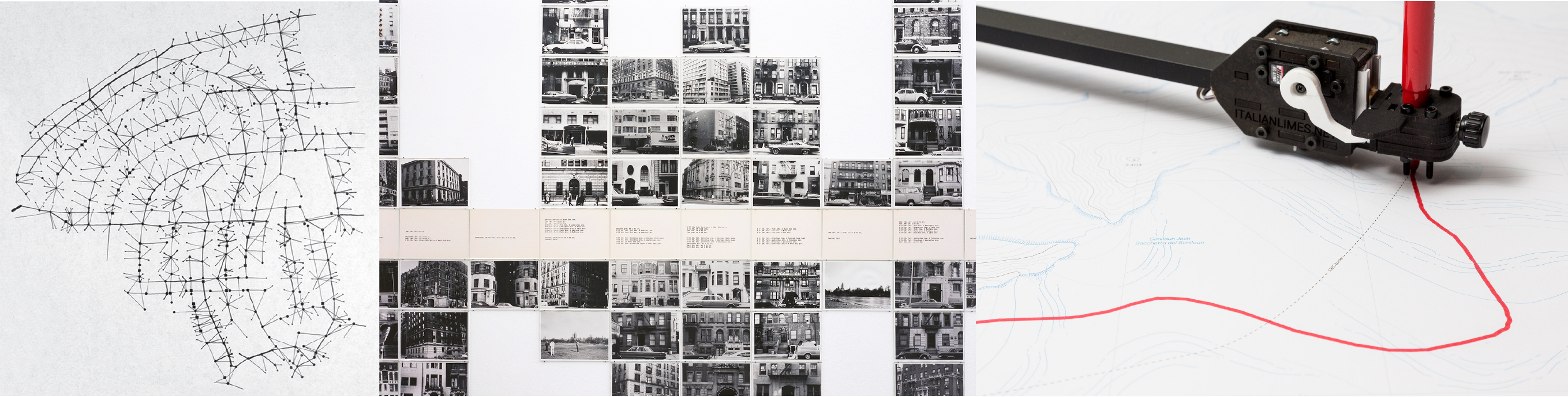
From left:
Dennis Wood. 2011. “Everything Sings: Maps for a Narrative Atlas” via Places Journal;
Hans Haacke Shapolsky et al. Manhattan Real Estate Holdings, a Real-Time Social System, as of May 1, 1971. 1971; Folder. Italian Limes. 2014
Methods in Spatial Research
Fall 2021
Friday 9-11, session A
1.5 credits
Avery 408
Dare Brawley, Assistant Director, Center for Spatial Research
dare.brawley (at) columbia.edu
office hours by appointment, sign up here)
TA: Adam Vosburgh
akv2118 (at) columbia.edu
office hours by appointment, sign up here
Description
This course provides an introduction to the critical use of geographic information systems (GIS) and the use of spatial methods for urban humanities research.
Maps and geographic analysis are key tools for interpreting the built environment and the social conditions it contains. GIS methods allow for the analysis of geographic features together with attributes (environmental, social, demographic, political) of those places. The thoughtful use of spatial data can reveal previously unseen patterns, changing the way we see and engage with our world. However, maps are never just representations, they are nearly always active agents in shaping the worlds they describe. With this in mind, students will be introduced to a range of approaches for creating and manipulating spatial data with a focus on the forms of authorship, design, subjectivity embedded in spatial data and its uses.
This is a “making & doing” workshop course that is open to students from within GSAPP, GSAS and the Columbia and Barnard Colleges and is designed to expand the disciplinary locations in which spatial data analysis takes place. Through hands-on exercises and weekly assignments participants will develop basic fluency with open-source mapping software, QGIS, methods of data collection and creation, and approaches and concepts in critical spatial analysis and map design.
Learning Objectives
After completing the course participants will:
- Develop robust familiarity with QGIS and its functions
- Gain fluency with foundational GIS concepts (including how the GIS data model abstracts geographic phenomena)
- Understand GIS spatial data types and the kinds of analysis that are possible with each
- Create new spatial datasets from field observation and participatory sensing
- Create new spatial datasets from archival sources
- Access and use multispectral satellite imagery
- Acquire fluency with visual design concepts central to cartographic representations
Course Overview
| Week | Date | Topic | Tutorial due | Assignment due |
|---|---|---|---|---|
| 1 | 9/10 | Introduction to Critical GIS + Spatial Data Types | ||
| 2 | 9/17 | Cartographic Projections + Mapping Existing Datasets | Tutorial 1 | |
| 3 | 9/24 | Making Data from Archives | Tutorial 2 | Assignment 1 |
| 4 | 10/1 | Making Data From Observation & Sensing | Tutorial 3 | Assignment 2 |
| 5 | 10/8 | Making Data from Satellites | Tutorial 4 | Assignment 3 |
| 6 | 10/15 | Maps & Narrative | Tutorial 5a or Tutorial 5b | Assignment 4 |
| no class | 10/29 | Portfolio Due |
Weekly Schedule, Readings, & Assignments
All course tutorials and assignments will be posted here on the course website. All readings will be posted on the course Google Drive folder or made available via hyperlink below. You must be signed in via Lionmail to access the Google Drive folder if you have a @barnard.edu email please request access.
Week 1 | 9/10 | Introduction to Critical GIS + Spatial Data Types
In class
Group map critiques. Examples to be distributed during class
Week 2 | 9/17 | Cartographic Projections + Mapping Existing Datasets
Readings (available on google drive or via hyperlink)
Corner, James. “The Agency of Mapping.” 2014.
Couclelis, Helen. “People Manipulate Objects (but Cultivate Fields): Beyond the Raster-Vector Debate in GIS.” 1992.
Review projects/precedent examples page. Pick out two-three examples each week to review thoroughly on your own.
Optional: Rankin, William. “Introduction Territory and the Mapping Sciences” in After The Map: Cartography, Navigation, and the Transformation of Territory in the Twentieth Century. Chicago: University of Chicago Press. 2016. [available online via CLIO here]
Week 3 | 9/24 | Making Data from Archives
Assignment 1 due – Intentional Misuse
Readings (available on google drive or via hyperlink)
Baics, Gergely, and Leah Meisterlin. “Zoning Before Zoning: Land Use and Density in Mid-Nineteenth-Century New York City.” 2016.
- This is an interdisciplinary paper with insights about both the history of land use in New York City and new methods for uncovering such histories with GIS. The link between these two aspects of the paper is really key and helpful, I think, as an illustration of how to develop spatial projects. They discuss three different sets of methods about three different urban land use phenomena. If you need to skim this piece read the introduction/conclusion and then pick at one of the sections on methods to focus on.
Wilson, Mabel. “The Cartography of W.E.B. Du Bois’s Color Line” in W.E.B. Du Bois’s Data Portraits: Visualizing Black America: The Color Line at the Turn of the Twentieth Century. Battle-Baptiste, Whitney, and Britt Rusert, eds. Princeton Architectural Press, 2018. [selections]
- This is a short essay on the significance and context of the cartographic work of W.E.B. Du Bois, a scholar and civil rights leader working in the United States in the early-mid 20th century. This essay discusses a historical mapping project, but unlike the other readings/projects for this week, it does not re-draw or further develop GIS methods/data from that historical material. Instead a key point this article brings to our conversations in class is the importance of interrogating historical/archival materials in relation to the context in which they were created.
- n.b. Scan includes required short essay by Mabel Wilson as well as optional introduction to the scanned plates and a selection of a few of the maps/data visualizations that were included in the exhibition discussed.
Majd Al-shihabi, Ahmad Barclay, et al. Palestine Open Maps. 2018-ongoing
oh no! the website for this project appears to be down, an all too common problem for under-resourced web-based mapping projects. we won’t discuss in class.
- explore the platform here
Digital Scholarship Lab, University of Richmond. Mapping Inequality 2015-ongoing
- explore the interactive maps & be sure to read the introduction
Week 4 | 10/1 | Making Data From Observation & Sensing
Assignment 2 due – Selective Digitization
Readings (available on google drive or via hyperlink)
House, Brian. “Stalking the Smart City.” 2019
Ferrari, Marco, Elisa Pasqual, Alessandro Busi, Aaron Gillett. A Moving Border: Alpine Cartographies of Climate Change [Selections]. 2019
Williams, Sarah, Jacqueline Klopp, Daniel Orwa, Peter Waiganjo, and Adam White. “Digital Matatus: Using Mobile Technology to Visualize Informality.” 2015.
Week 5 | 10/8 | Making Data from Satellites
Assignment 3 due – Mapping Observations
Readings (available on google drive or via hyperlink)
Kurgan, Laura. “Mapping Considered as a Problem of Theory and Practice.” 2013.
Please also review from week 2: Couclelis, Helen. “People Manipulate Objects (but Cultivate Fields): Beyond the Raster-Vector Debate in GIS.” 1992
Week 6 | 10/15 (last day of Session A) | Maps & Narrative
Assignment 4 due – Mapping Remotely
Readings
Please read these map-based articles from the New York Times:
- Serkez, Yaryna. “Opinion: Every Place Under Threat.” The New York Times, October 2, 2020, sec. Opinion.
- Plumer, Brad, Nadja Popovich, and Brian Palmer. 2020. “How Decades of Racist Housing Policy Left Neighborhoods Sweltering.” The New York Times, August 31, 2020, sec. Climate.
-
Columbia University Libraries provides access to NYTimes.com for all students. Please see instructions here to set up an account
- across these articles and when watching In Plain Sight try to focus on identifying the core narrative, and then on discerning how the narrative is being conveyed via the maps and other media used
- n.b. there is a longer list of New York Times map-based articles included at the end of the precedents page here, please feel free to read several of these in addition to the two listed above (if you choose to read an NYT map article that is not already on cited on the precedents page list, please include a link to the article in your discussion question post on Canvas).
10/29 | Mapping Portfolio Due
Requirements
Attendance at all six class sessions is required. You are expected to give engaged and generous participation in class discussions and in critique workshops with your peers. To help prepare reading conversations, each week you will post/pose one question for discussion to the class via Canvas by 7am each Friday (or for not early risers by Thursday night).
Skills-focused weekly tutorials are required and will expose you to multiple methods for engaging with spatial data. Tutorials include step by step instructions and are graded on completion (not accuracy).
Weekly map assignments will allow you to apply the skills acquired via tutorials and begin to experiment with creative applications of spatial methods. Five map assignments will be completed over the course of the six week course and as such are intended to be limited in scope; experimental; and geared towards learning and creative engagement rather than demonstrating advanced skills. Assignment descriptions and associated assessment rubrics will be distributed each week.
For the final course session you will assemble your map assignments into a single document/portfolio/atlas.
Final assessment will be based on:
Attendance, engaged participation & discussion questions 20%
Weekly tutorial completion 30%
Weekly map assignments & compiled/revised map portfolio 50% (10% each)
Software
Geographic Information Systems is not a software. As such this course will not seek to provide students with proficiency in a particular software platform.
Tutorial resources will be primarily provided for QGIS 3.16 (LTR). This is an open source software program for geographic analysis that runs on Windows, Mac, and Linux operating systems. All students will be expected to download and install QGIS 3.16 (LTR). Documentation for QGIS is available here, and a training manual with good basic tutorials is available here and an introduction to GIS methods using QGIS is available here.
Information regarding other GIS softwares will be provided in course resources.
Knowledge of design and layout programs (Adobe Illustrator, and InDesign) may be useful to you but is not required.
Course google drive folder
All readings and course data will be available via Google Drive here.
Academic Integrity
The intellectual venture in which we are all engaged requires of faculty and students alike the highest level of personal and academic integrity. As members of an academic community, each one of us bears the responsibility to participate in scholarly discourse and research in a manner characterized by intellectual honesty and scholarly integrity.
Scholarship, by its very nature, is an iterative process, with ideas and insights building one upon the other. Collaborative scholarship requires the study of other scholars’ work, the free discussion of such work, and the explicit acknowledgement of those ideas in any work that inform our own. This exchange of ideas relies upon a mutual trust that sources, opinions, facts, and insights will be properly noted and carefully credited.
In practical terms, this means that, as students, you must be responsible for the full citations of others’ ideas in all of your research papers and projects; you must be scrupulously honest when taking your examinations; you must always submit your own work and not that of another student, scholar, or internet agent.
Any breach of this intellectual responsibility is a breach of faith with the rest of our academic community. It undermines our shared intellectual culture, and it cannot be tolerated. Students failing to meet these responsibilities should anticipate being asked to leave Columbia.
For more information on academic integrity at Columbia, students may refer to the Columbia University Undergraduate Guide to Academic Integrity as well as the GSAPP Honor System and Plagiarism Policy.
Community & Accessibility
This is a discussion and collaborative-critique based course. All students and the instructor must be respectful of others in the classroom. If you ever feel that the classroom environment is discouraging your participation or is problematic in anyway please contact me.
GSAPP is committed to full inclusion of all students. Students needing any form of accommodation due to a disability should check in with Disability Services (DS) and speak with me at the beginning of the semester to provide the accommodations letter from DS. Alternatively you may ask your advisor to consult with me regarding your accommodations.
Email Policy
Students should not rely on or expect an immediate response to questions sent via email to the instructor. Please begin assignments with enough time to attend office hours or ask a question several days before the assignment is due.
Learning how to troubleshoot technical issues and locate relevant resources is crucial in your long-term success with GIS methods. With this in mind emails with technical questions must at a minimum contain the following:
- a clear description of what you are trying to do, and what the problem is
- a summary of the steps you have already taken to address the issue
- screenshots (where applicable) that help to explain the problem
- a link to at least one website you consulted for assistance with the issue before writing the email.The QGIS docs is a good starting place as is GIS Stack Exchange.
Bibliography
Baics, Gergely, and Leah Meisterlin. “Zoning Before Zoning: Land Use and Density in Mid-Nineteenth-Century New York City.” Annals of the American Association of Geographers 106, no. 5 (September 2, 2016): 1152–75.
Battle-Baptiste, Whitney, and Britt Rusert, eds. W.E.B. Du Bois’s Data Portraits: Visualizing Black America: The Color Line at the Turn of the Twentieth Century. First edition. [Amherst, Massachusetts] : Hudson, NY: The W.E.B. Du Bois Center at the University of Massachusetts Amherst ; Princeton Architectural Press, 2018.
Corner, James. “The Agency of Mapping.” In Landscape Imagination: Collected Essays of James Corner 1990-2010. New York, UNITED STATES: Princeton Architectural Press, 2014.
Couclelis, Helen. “People Manipulate Objects (but Cultivate Fields): Beyond the Raster-Vector Debate in GIS.” In Theories and Methods of Spatio-Temporal Reasoning in Geographic Space, edited by A. U. Frank, I. Campari, and U. Formentini, 639:65–77. Lecture Notes in Computer Science. Berlin, Heidelberg: Springer Berlin Heidelberg, 1992.
Desimini, Jill, and Charles Waldheim. “Introduction: Projecting the Landscape Imaginary.” In Cartographic Grounds : Projecting the Landscape Imaginary. New York: Princeton Architectural Press, 2016.
Ferrari, Marco, Elisa Pasqual, and Andrea Bagnato. A Moving Border: Alpine Cartographies of Climate Change. New York, NY: Columbia Books on Architecture and the City, 2019.
House, Brian. “Stalking the Smart City.” Urban Omnibus 2019
Kurgan, Laura. “Mapping Considered as a Problem of Theory and Practice.” In Close up at a Distance : Mapping, Technology, and Politics, 9–18. Brooklyn, NY: Zone Books, 2013.
Mörtenböck, Peter, and Helge Mooshammer, eds. Informal Market Worlds: The Architecture of Economic Pressure. Rotterdam: NAI010 Publishers, 2015.
Rankin, William. “Introduction Territory and the Mapping Sciences” in After The Map: Cartography, Navigation, and the Transformation of Territory in the Twentieth Century. Chicago: University of Chicago Press. 2016.
Williams, Sarah, Jacqueline Klopp, Daniel Orwa, Peter Waiganjo, and Adam White. “Digital Matatus: Using Mobile Technology to Visualize Informality.” ACSA Annual Meeting Proceedings, The Expanding Periphery and the Migrating Center, 2015, 9.
Wood, Dennis. “Everything Sings: Maps for a Narrative Atlas.” In Places Journal. 2011.
Woods, Clyde Adrian., and Katherine. McKittrick. “No One Knows the Mysteries at the Bottom of the Ocean.” In Black Geographies and the Politics of Place. Toronto, Ont. : Cambridge, Mass.: Between the Lines ; South End Press, 2007.