Aerosol Reparations Tutorial
V. Mitch Mcewen
Jump to: Introduction | Tutorial Links
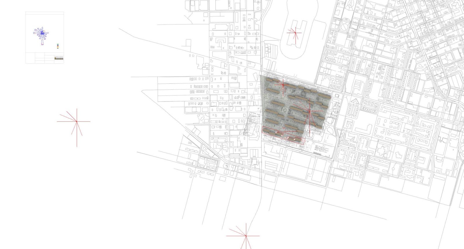
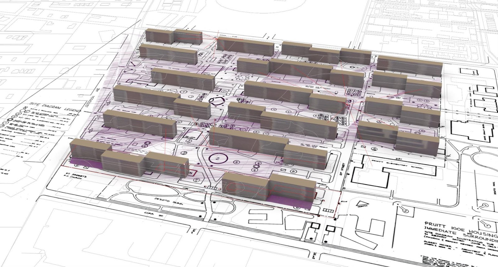
Image Credit: V. Mitch Mcewen
Introduction
This tutorial comes out of the presentation that I gave at CSR related to aerosol experiments that the US military conducted for years at the Pruitt-Igoe public housing in St Louis. Records of those military experiments were completely declassified in 2012. A documentary film titled Target: St. Louis, released in 2018, addresses this history. Behind the Fog How the U.S. Cold War Radiological Weapons Program Exposed Innocent Americans, a book by sociologist Lisa Martino-Taylor, published also in 2018, puts the Pruitt-Igoe testing in context of the US military’s Cold War radiological weapons program. Considering the significant role of Pruitt-Igoe in American architectural history, the weaponization of the air around Pruitt-Igoe raises not just local questions for St Louis, but disciplinary questions for architecture, architectural history, and urban planning. How can we shift from humanizing the victims of spatial violence to analyzing and subverting the methods of spatial violence? What methods need to be invented to process the extensive violence these spatial disciplines have enacted?
My presentation and this tutorial aim to make open a line of inquiry around drawings within these open-ended broader questions. I am specifically interested in the distinctions between illustrating, diagramming, orthographic drafting, and modeling. In summary, these distinctions serve to produce terms of facticity within a political context. That is not to say that the distinctions do not matter. Rather, it is important to consider what they matter for.
My approach to bringing the facts of the radiological simulations into the architectural understanding of Pruitt-Igoe in many ways operates as illustration. I produce a drawing that accompanies a text. The lines extend in different directions and swirl. However, the way that I am approaching this may be more important than this one drawing. I am drawing Pruitt-Igoe in some ways as if it were a planet, a place defined by atmospheres.
These drawings, to the extent that they illustrate, should be compared to illustrations of planetary rotation and wind patterns. Within the terms of reparations and our capacity to design reparations, I am thinking about the extent to which the distribution of pollution and toxicity is racialized. That racialization depends not only on the corporeal fantasy of phenotypes and the social performance of cast, but also on environmental dynamics such as the wind.
The techniques behind this initial drawing could also be deployed towards something more like reparative analysis, through vectors tracing air rights of repair through the wind.
Tutorial Links
Historical Site Plan: Import PDF / JPG in Rhino
Existing Streets: See my Open Street Maps in Rhino/ GH Tutorial
Animating Particle Paths: See Karl Daubmann’s tutorial video Animating Particle Fields in Grasshopper
A more robust version would work with this dataset (linked here) and this atmospheric modeling tool (linked here) and/or the dynamics of rotating “earth-attached reference frames,” with the math explained here.

Image Credit: V. Mitch Mcewen